
The Corridor
| Last on the list is a man-made running area. It's a paved, recreational Corridor that runs from Downtown Minneapolis west into St. Louis Park. Running The Corridor can be its own workout, especially if you're starting from downtown. But the reason for this Corridor is to hook you up to the parkway system. From downtown, you'll access the Guthrie hills area, Lake of the Isles, Cedar Lake, and Theodore Wirth Park with Eloise Butler Sanctuary. Take a right, take a left, or keep going straight and turn around. Too many great running choices. |
Click on the map for a larger image
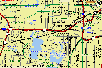
Distances: 3.6 miles one way (from downtown to Hwy 100) 7.2 miles round trip |
||
| Water: No water pumps on the trail. Bring your water bottle, especially if it's warm. | ||
| Recommended Start Point: Downtown Minneapolis, near the Target Center. Go behind the building. Run West along Second Avenue North, take a right at 7th Street North, and a left at Third Avenue North. Then, look for a round green sign that says "Commuter Trail". This marks the beginning of the trail. At first you'll be running through industrial wasteland, but then it will open up. | ||
| Parking: In Downtown Minneapolis you'll be faced with meter or ramp parking. | ||
| Diversions: You'll cruise by the Sculpture Garden where there's the giant cherry on a spoon. You won't see it off the trail, so take a right at the "Dunwoody Trail" sign. Do a loop and then get back on the path. |